
Space-derived data and information plays a key role in evidence-based decision-making for the efficient management of the environment, assets and communities. Around 40 per cent of the Sustainable Development Goal targets rely on the use of geolocation and Earth observations. Geospatial information can help global stewardship, enabling faster, more accurate and trustworthy support to inform decisions, monitor progress, and assess the impact of interventions. Geospatial data should be accessible, available, actionable, and affordable to benefit people and inform practices, processes and policies. However, such information alone cannot bring about improved management, decisions or change. In addition, many developing nations continue to lack the infrastructure and trusted data to make evidence-based decisions.
In this connection, ESCAP is promoting the regional cooperation in integrating geospatial information for resilience building and sustainable development, such as the “Space+” initiatives which go beyond the traditional space applications approaches to support implementation of the Asia-Pacific Plan of Action on Space Applications for Sustainable Development (2018-2030) and will seek to: (a) leverage frontier technologies such as artificial intelligence, Internet of Things, cloud computing and Big Data; (b) engage end users in multiple areas, such as the youth or the private sector; (c) more effectively manage information through the creation of a regional or national cloud-based metadata platform; and (d) strengthen implementation through enhanced partnerships with global and regional stakeholders.
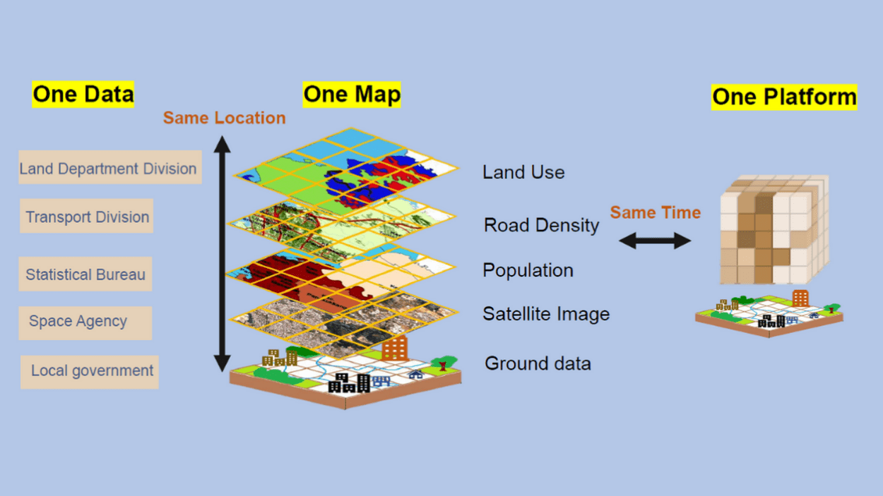
In addition, geospatial applications offer stakeholders, across multiple agencies, the option to create planning scenarios, analyse different site options, and assess impacts from a local to national levels. For example, the “OneData-OneMap-OnePlatform" initiative, currently under development, encourages developing nations to build a platform that utilizes frontier technologies and integrates with Big Earth Data to support local SDG monitoring and decision-making. In this regard, ESCAP is working with its member States and partners such as UN-GGIM to strengthen the institutional capacity in integrating geospatial information to help stakeholders in developing nations explore the possibilities for effective country-level SDG assessment and monitoring, leveraging geospatial and digital tools for increased community engagement, using geo-referenced and integrated data for urgent and necessary decision-making, and helping decision makers understand the full potential, limitations, and application of geospatial information.


